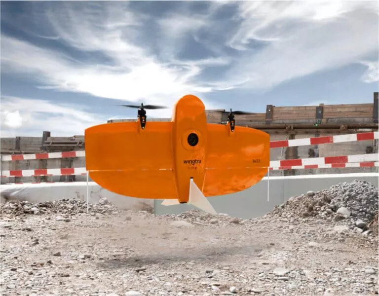
Wingtra Mapping Drone
.jpg)
Wingtra One - GEN II
Wingtra One - GEN II - an easy to use fixed wing VTOL mapping drone, that consistently and effectively collects high-quality survey data from large areas both fast and cost effective.Map Faster and Map larger - Anywhere
Map FasterWingtraOne GEN II’s unique set of features empowers you to minimize your time flying and get more work done, be it another project in the field or analyzing your data at the office.
* Efficient fixed-wing flight - 16 m/s flights for up to 59 minutes per flight
Map Larger
Whether it´s a highway, an industrial complex or a mine, you can now take on large projects that were previously impossible to map with a drone. And it takes just a few hours.
* covers an area of 110 ha per flight
Map Anywhere
The VTOL (Vertical Take-off and Landing) design enables Wingtra One to take-off and land almost anywhere - even in confined spaces or on rought terrain. Map large challenging projects as highways, industrial complexes, or mines in just a few hours.
Cost effective
Faster data collection and expanded coverage mean fewer people in the field for less time, lowering the man-hour costs associated with data collection
Data quality that will set you apart
Equipped with a 42 MP full frame Sony camera, with a flying altitude up to 93 m, enables you with every picture to capture- more ground
- more detail
- Sharp and undistorted nadir images with high pixel density – GSD down to 0,7 cm/px.
- Built-in multi-frequency PPK GNSS receiver and 42 MP sensor delivers absolute horizontal accuracy down to 1 cm without GCPs (Group Control Points that have a known geographic location)
- High quality optics – enables map reconstruction with smaller overlaps
- Smart camera placement to extend product longevity
Software for a smooth workflow
WingtraOne comes with a rugged tablet and a feature-rich, easy-to-use flight planning app, so you can perform successful data collection from day one.- WingtraPilot Software (pre-installed on tablet) enables you to
- Import KML files directly from GIS programs, and optimal flight paths is contructed
- Corridor map. Fast, efficient coverage of long, narrow stretches
- Terrain follow. Safe and effective mapping from steady altitudes in mountainous areas
- Fly with pre-downloaded offline maps
- Pause and resume. At any time during flight, you can either pause and resume the survey mission or prompt the drone to fly back to its take-off location automatically
- Battery swap and resume. Automatically splits large missions, pausing flight and resuming after the batteries have been swapped
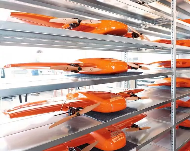
WingtraOne GEN II
Mapping Drone
A Reliable workhorse
No matter the conditions, WingtraOne operates safely and delivers high-quality data, consistently.* Fly safe in sustained wind up to 12m/s and gusts up to 18 m/s.
* Engineered and assembled in Switzerland. Each drone is subjected to more than 300 rigorous tests to ensure the highest quality standard
* Industry-leading reliability. More than 100,000 flights and 6 years of continuous testing and enhancements will ensure maximum up-time for your operations.
* Predictive self-diagnosis. WingtraOne self-diagnosis component malfunctions using advanced machine learning algorithms based on thousands of flights.
*Automated safety checks. Before every flight, the WingtraOne automatically checks its own sensors and actuators to make sure you can fly safely.
Payloads - a camera for every job
Cameras:WingtraOne GEN II makes no compromises on aerial image quality. Whether you need data for orthophotos, 3D models or multispectral mapping, WingtraOne carries the best camera for every application. As you exchange cameras in the field, various types of data can be acquired with the same drone.
Choose between:
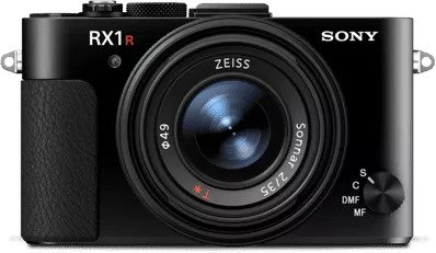
Sony RX1R II
Ultra-high resolution 42 MP camera with full-frame sensor and low distortion lens. Together with PPK, this camera delivers absolute accuracy down to 1 cm (0.4 in).
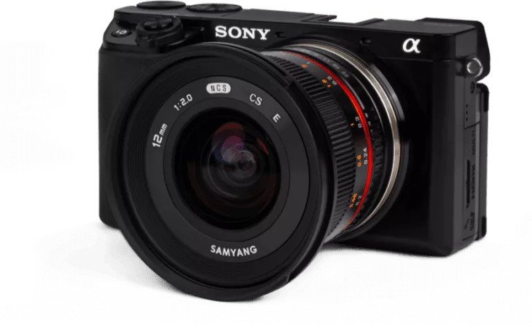
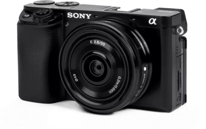
Sony a6100
The a6100 camera from Sony offers the best combination of accuracy and coverage for an affordable price.
Oblique Sony a6100
Optimised to map vertical structures, the Oblique Sony a6100 allows you to generate high-resolution 3D meshes with centimeter level absolute accuracy
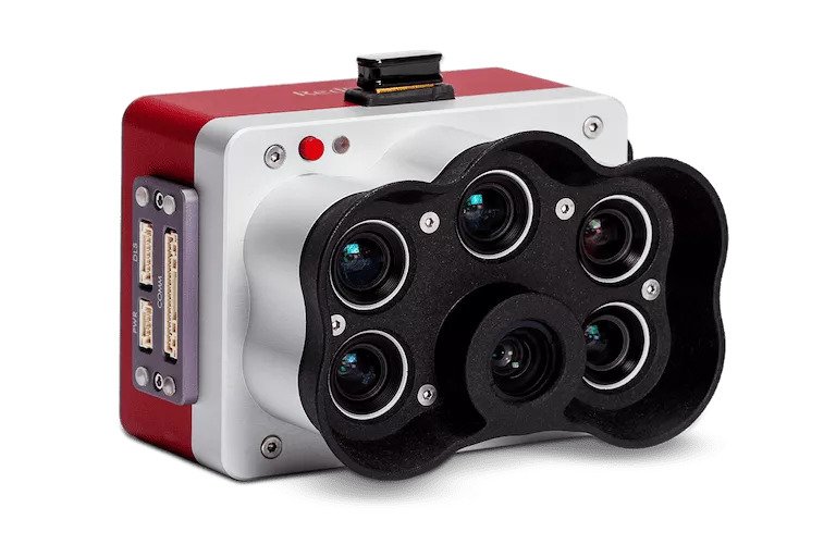
MicaSense RedEdge-P
Premium multispectral camera, which combines a panchromatic sensor with five narrow bands to produce high-resolution multispectral and RGB from one flight.
About Wingtra
Headquartered in Switzerland, Wingtra is the world’s leading VTOL drone producer for mapping, survey and mining industry professionals. Since its market entry in early 2017, Wingtra has partnered with more than 70 of the biggest equipment dealers and has been selling mapping drones globally ever since.Wingtra is based in the heart of Zurich, Switzerland. In a 1,000 m2 (10,800 ft2) office, the company houses 100+ employees, out of which more than 30 focus on R&D. Wingtra’s engineers are graduates from the world’s 3rd best university for engineering and technology, ETH Zurich (Top Universities, 2019) and are among the leading research engineers in VTOL technology. Drones are assembled in-house in Zurich by our production team, and technical specialists support our customers globally.
The WingtraOne drone is rooted in years of robotics research at the Autonomous Systems Lab—one of the world’s best drone laboratories. Several of Wingtra’s employees have based their doctoral and master projects on VTOL technology and now pursue research and development at Wingtra.